What is the history behind the name Alguazas?
The name Alguazas comes from the Arabic word "Aluazta" or "Alhuasta," meaning "the one in the middle." This reflects its geographical location between the Mula and Segura rivers. The name was first documented in the 13th century when Alfonso X granted the town to his wife, Violante of Aragon.
History
What can you tell me about the Torre de los Moros?
The Torre de los Moros, also known as the Old Tower or the Bishop's Tower, dates back to the early 12th century. It was built on a Muslim cemetery and served as a military refuge and prison for bishops. Despite suffering damage over the years, it has been partially restored and now houses a small ethnological museum.
Sights
Torre de los Moros
What events are held during the fiestas patronales in June?
Alguazas celebrates its fiestas patronales in June, honoring San Onofre on the 12th and San Antonio de Padua on the 13th. Highlights include a parade of floats, concerts, religious events, and the gala for the presentation of the Damas and the election of the Festival Queen.
Festivals & events
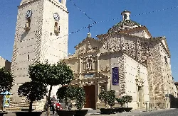
What is the significance of the Iglesia de San Onofre?
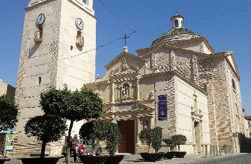
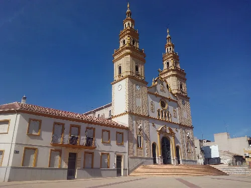
The Iglesia de San Onofre is a notable church in Alguazas, showcasing a blend of architectural styles including Mudéjar, Baroque, and Neoclassical. Construction began in 1529 and it features unique elements like a wooden ceiling added in 1566 and a new facade completed in 1642.
Sights
Iglesia de San Onofre
How did Alguazas develop its industry over the years?
Alguazas has seen significant industrial growth, particularly in the canning sector, which flourished after the Spanish Civil War. However, since the 1980s, this industry has declined, leading to economic stagnation compared to neighboring municipalities.
Living there
For residents
What are the main sports played in Alguazas?
Football is the most popular sport in Alguazas, with several clubs competing at regional levels. Additionally, baseball has a strong presence, featuring two national teams. Other sports like rhythmic gymnastics, handball, and basketball are also practiced in the municipality.
Nature
For residents
What is the geographical setting of Alguazas like?
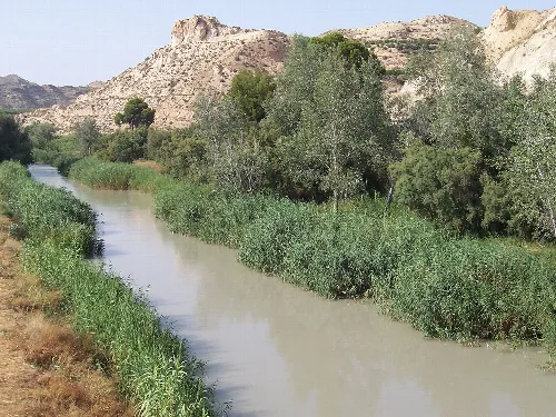
Alguazas is situated between the valleys of the Segura and Mula rivers, characterized by a relatively flat terrain. The Segura flows on the eastern boundary, while the Mula runs along the southern side, creating a unique landscape with various dry ramblas that can carry water during seasonal rains.
Nature
For residents
Are there any archaeological sites in Alguazas?
Yes, Alguazas has several archaeological sites dating back to the Bronze Age, including collective burial sites and a flint workshop at Cabezo de la Zobrina. These findings highlight the area's long history of habitation and cultural significance.
History
What is the significance of Semana Santa in Alguazas?
Semana Santa, or Holy Week, in Alguazas has roots dating back to the 16th century. It features processions, including the notable Nuestro Padre Jesús Nazareno, and is marked by the traditional Baile de los Santos, which has become a significant cultural event in the region.
Festivals & events
How is public transportation organized in Alguazas?
Public transportation in Alguazas is managed under the Movibus system, which provides interurban bus services. The municipality is well-connected by roads, including the A-30 motorway, facilitating travel to nearby towns and cities.
Getting there
For residents
 espana.net