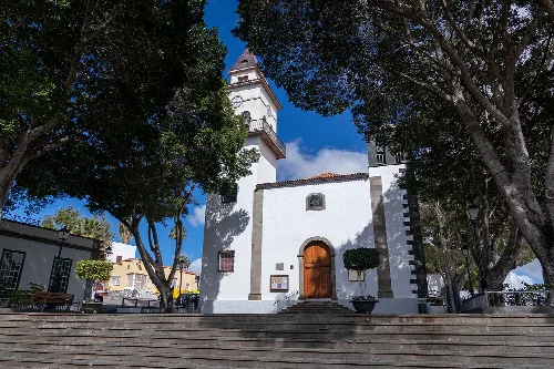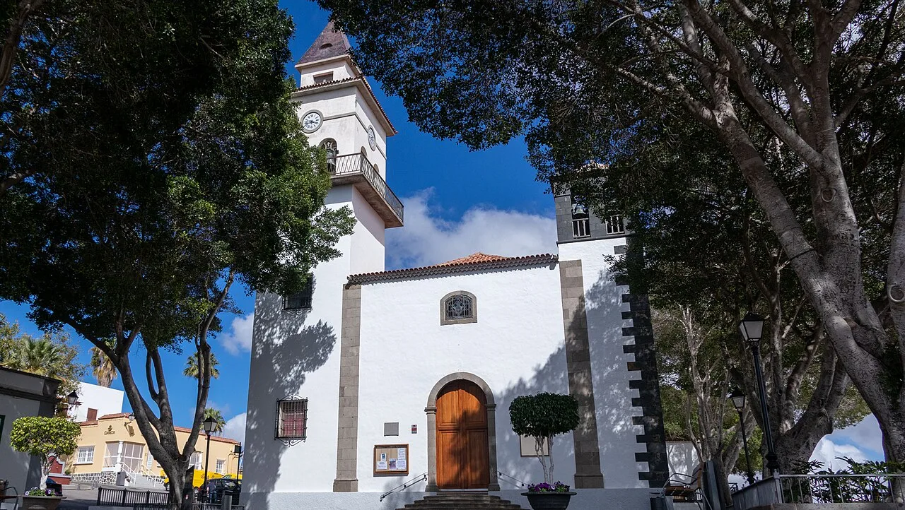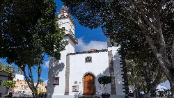
Facade of San Miguel Arcángel church with trees and blue sky. Mihailschwarz, CC BY-SA 4.0

San Miguel de Abona

Canary Islands

23,960Population
42 km²Area
58 mElevation
38620Postal code

San Miguel de Abona is a municipality located in the southern part of Tenerife, within the province of Santa Cruz de Tenerife. Known for its historical architecture and natural landscapes, it features a mix of volcanic terrain and coastal areas, making it a unique destination in the Canary Islands.

02Geography

San Miguel de Abona is situated in the southern region of Tenerife, bordered by Granadilla de Abona, Vilaflor de Chasna, and Arona. The municipality encompasses an area of 42 km², with its highest point reaching approximately 1,070 meters above sea level in the El Bucio area.

Coastline
Partially cliffed with small volcanic sand beaches and pebbles.
Climate
Arid and dry, with high temperatures year-round.
Protected areas
Includes Montaña Amarilla and part of Roque de Jama.
Natural features
Volcanic cones and barrancos, including Uchoba and La Orchilla.

03History

The area has been inhabited since Guanche times, forming part of the ancient kingdom of Abona. Following the conquest by Alonso Fernández de Lugo in 1496, colonization began, leading to the establishment of San Miguel as a parish and later a municipality.

Discover San Miguel de Abona, a historic municipality in Tenerife known for its volcanic landscapes and cultural heritage.

04Cultural Heritage

San Miguel de Abona's urban center is recognized as a Historic Ensemble, showcasing well-preserved architecture from the 18th to 20th centuries. Key landmarks include the parish church of San Miguel and notable buildings like El Calvario.

Landscape with lava field and Montaña Roja on the horizon from Montaña Amarilla.
View from Montaña Amarilla showing the lava field and Montaña Roja in the background in San Miguel de Abona.
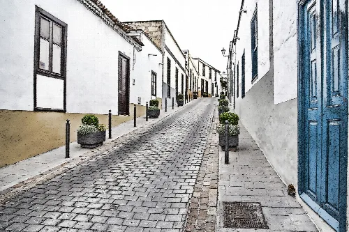
Cobblestone street with white houses and flower pots in San Miguel de Abona.
Street in San Miguel de Abona's historic center with white houses and flower pots.

05Economy and Daily Life

The economy of San Miguel de Abona has increasingly relied on tourism, particularly with the development of golf resorts like Amarilla Golf and Golf del Sur. Agriculture also plays a role, with crops such as bananas and tomatoes being significant.

Tourism impact
Tourism has grown significantly since the 1980s.
Agricultural products
Includes bananas, potatoes, and tomatoes.
Transport links
Connected by TF-1 and TF-28 highways.
San Miguel de Abona · Data
Province
Santa Cruz de Tenerife
Autonomous community
Canary Islands
Population
23,960
Area
42 km²
Elevation
58 m
Postal code
38620
Website
http://www.sanmigueldeabona.es/
Coordinates
28.0975, -16.6172

Photos

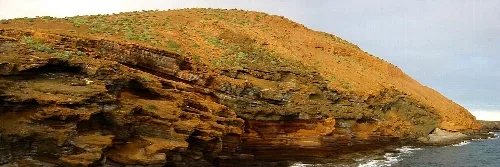
Layered rock formations at Yellow Mountain, Tenerife.
Yellow Mountain in Tenerife with layered rock formations and a hill profile in the background.
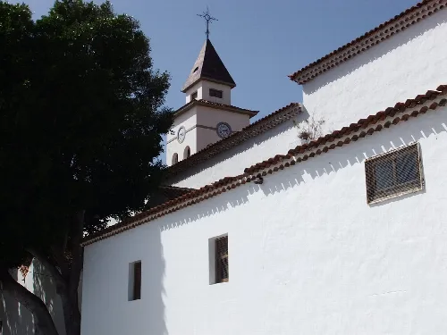
White church with tower and red tiled roof in San Miguel de Abona.
Church of San Miguel Arcángel in San Miguel de Abona with its tower and red tiled roof.
White church with bell tower and trees around in San Miguel de Abona.
Church in San Miguel de Abona surrounded by trees and with steps at the entrance.
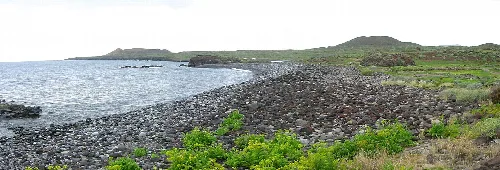
Rocky coast with water and vegetation, Yellow Mountain in the distance.
Coast in San Miguel de Abona with Yellow Mountain in the background.

Frequently asked questions

Facade of San Miguel Arcángel church with trees and blue sky.

What can you tell me about the Iglesia de San Miguel Arcángel?

The Iglesia de San Miguel Arcángel is a notable church located in the urban center of San Miguel de Abona. It was built in the 17th century and has been a significant religious site for the local community. The church's architecture reflects the historical heritage of the area, making it a key landmark in the town.

Sights Iglesia de San Miguel Arcángel
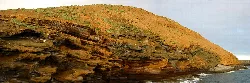
Layered rock formations at Yellow Mountain, Tenerife.

What is Montaña Amarilla and why is it significant?

Montaña Amarilla is a volcanic cone located along the coast of San Miguel de Abona. It is known for its striking yellow-orange coloration, resulting from its geological composition. The area surrounding Montaña Amarilla is also a protected natural monument, making it an important site for both conservation and tourism.

Nature Montaña Amarilla

How did San Miguel de Abona get its name?

The name San Miguel de Abona originates from a 17th-century hermitage dedicated to the archangel Michael, located in the town's foundational area. The term 'Abona' is believed to come from the Guanche language, meaning 'large stones' or 'quarries,' referring to the region's historical significance.

History

What are some local events in San Miguel de Abona?

San Miguel de Abona hosts various local events, including the celebration of Martes de Carnaval and the feast day of San Miguel Arcángel on September 29. Additionally, the Camino del Hermano Pedro pilgrimage occurs annually, attracting participants from nearby areas.

Festivals & events

What is the climate like in San Miguel de Abona?

San Miguel de Abona experiences a typical southern Tenerife climate, characterized by high temperatures throughout the year and low rainfall. This arid and dry climate makes it a favorable destination for visitors seeking warm weather and outdoor activities.

Nature

Are there any protected natural areas in San Miguel de Abona?

Yes, San Miguel de Abona includes several protected natural areas, such as the Montaña Amarilla natural monument and part of the Roque de Jama natural monument. These areas are important for conservation and offer opportunities for outdoor recreation and exploration.

Nature

What type of food can I expect in San Miguel de Abona?

In San Miguel de Abona, visitors can enjoy traditional Canarian cuisine, which includes dishes like papas arrugadas (wrinkled potatoes) served with mojo sauce, fresh seafood, and local cheeses. The area's agricultural heritage also influences the availability of fresh fruits and vegetables in local markets.

Food & drink

What is the population of San Miguel de Abona?

San Miguel de Abona has a population of approximately 23,960 residents. The town has seen population growth, particularly since the 1980s, due to tourism and development in the area, contributing to its vibrant community.

Living there For residents
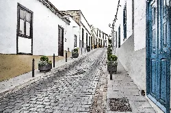
Cobblestone street with white houses and flower pots in San Miguel de Abona.

What is the historical significance of the casco urbano in San Miguel de Abona?

The casco urbano of San Miguel de Abona is recognized as a Cultural Heritage site due to its well-preserved historical architecture. It showcases traditional Canarian buildings from the 18th to 20th centuries, reflecting the town's rich cultural and architectural heritage.

History For residents

How can I get to San Miguel de Abona?

San Miguel de Abona is accessible via the Autopista del Sur TF-1 and the General del Sur TF-28. Public transport options include bus services connecting the municipality with other areas of Tenerife, making it convenient for visitors and residents alike.

Getting there

Map

Nearby

Church in Arona square with trees and people walking.
Arona
Santa Cruz de Tenerife · 87,793 inhabitants
View of a town in a valley with the sea in the background.
Adeje
Santa Cruz de Tenerife · 50,021 inhabitants
View of white houses in Arico with the blue sea behind.
Arico
Santa Cruz de Tenerife · 9,505 inhabitants

Own text, written with AI assistance from the facts in Wikipedia · San Miguel de Abona · Data: Wikidata Q677038 · Photos: Wikimedia Commons, see individual licenses. · CC BY-SA 4.0