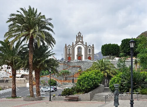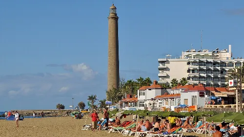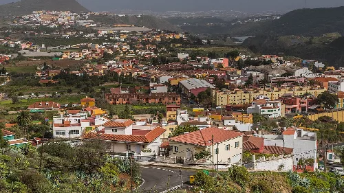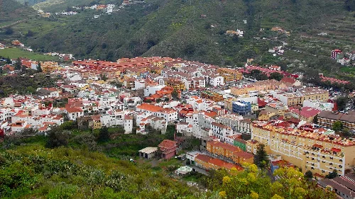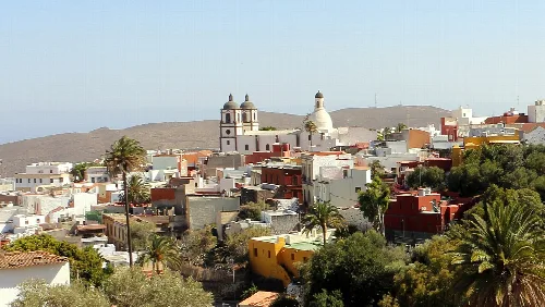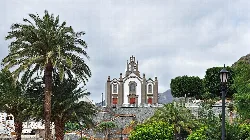
Santa Lucía's church with palm trees and mountains in the background. Marc Ryckaert, CC BY 3.0

Santa Lucía de Tirajana

Canary Islands

78,584Population
61.56 km²Area
68 mElevation
35110Postal code

Santa Lucía de Tirajana is a municipality located in Gran Canaria, part of the Canary Islands. It is characterized by its diverse geography, ranging from coastal urban areas to traditional inland settlements, and has a significant population engaged in commerce and agriculture.

02Geography

Situated in the eastern-central part of Gran Canaria, Santa Lucía de Tirajana is bordered by San Bartolomé de Tirajana and Agüimes. The municipality covers an area of 61.56 km², with its capital located at an elevation of 680 m, while the highest point reaches 1,668.77 m at Alto de La Cruz.

Distance to Las Palmas
51 km
Climate
Semi-arid cold
Average annual temperature
16.7 °C
Average annual precipitation
277 mm

03History

The origins of Santa Lucía de Tirajana trace back to the late 15th century when lands were granted to Tomás Rodríguez de Palencia. Initially focused on sugar production, the area later diversified into cereal and wine cultivation, facing challenges from locust plagues in the 17th and 18th centuries.

Santa Lucía de Tirajana, a diverse municipality in Gran Canaria, features coastal urban areas and rich agricultural traditions.

04Economy and Daily Life

The economy of Santa Lucía de Tirajana is primarily driven by commerce, particularly in the coastal area. Agriculture remains significant, with greenhouses producing various crops, while many residents work in tourism or local industries.

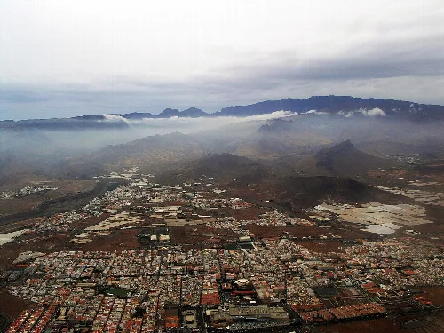
Aerial view of Vecindario and Caldera de Tirajana in Gran Canaria.
Aerial view of Vecindario and Caldera de Tirajana in Gran Canaria, with mountains and clouds in the background.
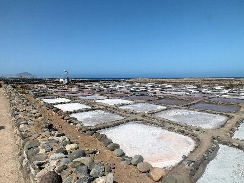
Salt flats with pools and stone walls in a dry landscape
Salinas de Tenefé, 18th-century salt flats still in operation in Santa Lucía de Tirajana

05Cultural Heritage and Festivals

Santa Lucía de Tirajana boasts a rich cultural heritage with various archaeological sites and traditional architecture. The municipality celebrates several festivals, particularly in honor of its patron saint, Santa Lucía, and the Virgen del Rosario.

Santa Lucía de Tirajana · Data
Province
Las Palmas
Autonomous community
Canary Islands
Population
78,584
Area
61.56 km²
Elevation
68 m
Postal code
35110
Website
http://www.santaluciagc.com/
Coordinates
27.9121, -15.5407

Photos

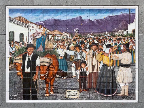
Tile showing farmers, a woman figure, and mountains in the background.
Painted tile depicting the Farmers' Pilgrimage in Santa Lucía de Tirajana, with farmers and mountain landscape in the background.
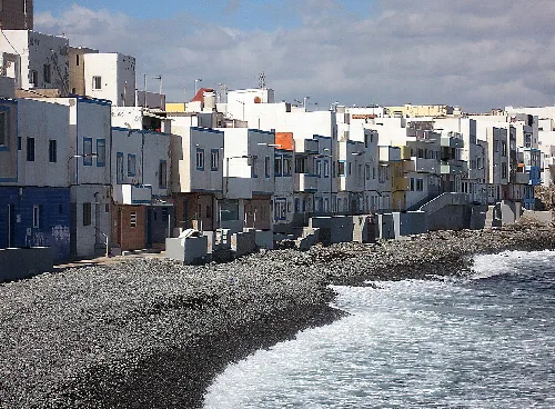
White houses on the coast of Pozo Izquierdo next to the sea.
Colorful white houses along the coast of Pozo Izquierdo with the sea in the foreground.
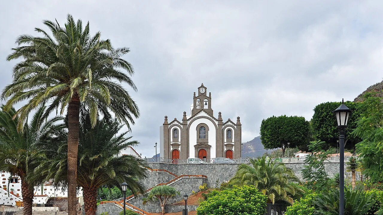
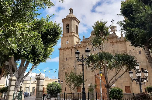
Baroque-style church façade in Santa Lucía de Tirajana, with palm trees and gardens.
The church of Santa Lucía with its baroque façade in the center of Santa Lucía de Tirajana, surrounded by palm trees and gardens.
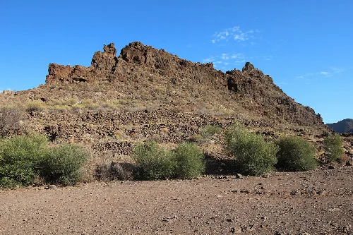
Ruins of an ancient structure in a dry landscape with scattered vegetation
Ruins of an ancient structure at the La Fortaleza archaeological site in Santa Lucía de Tirajana
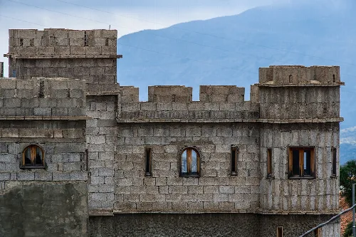
Stone block construction with mountains in the background.
View of a stone block structure in Santa Lucía de Tirajana with mountains in the background.

Frequently asked questions

Santa Lucía's church with palm trees and mountains in the background.

What is the significance of St. Lucy's Church in Santa Lucía de Tirajana?

St. Lucy's Church, dedicated to Santa Lucía de Siracusa, is a central landmark in the municipality. It reflects the town's history and cultural heritage, having been established in the late 15th century. The church is a focal point for local festivities, especially during the celebrations in honor of its patron saint on December 13th.

History St. Lucy's Church
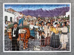
Tile showing farmers, a woman figure, and mountains in the background.

What can you tell me about the Romería de los Labradores festival?

The Romería de los Labradores is a vibrant festival celebrated on the Sunday following St. Lucy's Day, attracting thousands of visitors. Participants dress in traditional attire and enjoy local foods and drinks, including cheese, chicharrones, and the local liquor 'Mejunje.' The event features decorated carts parading through the streets, showcasing the region's agricultural heritage.

Festivals & events

What is the climate like in Santa Lucía de Tirajana?

Santa Lucía de Tirajana has a semi-arid cold climate, with average temperatures ranging from 13 °C in January to 21 °C in August. The annual average temperature is around 16.7 °C, and the area receives approximately 277 mm of rainfall each year, making it relatively dry compared to other regions.

Nature For residents

What are the main economic activities in Santa Lucía de Tirajana?

The economy of Santa Lucía de Tirajana is primarily driven by commerce, especially in the coastal area of Vecindario. Agriculture also plays a role, with greenhouse farming for crops like tomatoes and bananas. Additionally, many residents work in tourism, particularly in nearby San Bartolomé de Tirajana, and in local industries.

Living there For residents
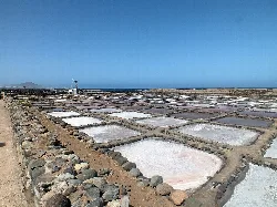
Salt flats with pools and stone walls in a dry landscape

What are the Salinas de Tenefé and why are they important?

The Salinas de Tenefé are historical salt flats that date back to the 18th century and are still operational today. They are significant for their cultural and economic contributions to the region, reflecting traditional salt production methods and the local economy's reliance on natural resources.

Sights Salinas de Tenefé

How do I get to Santa Lucía de Tirajana from Las Palmas?

To reach Santa Lucía de Tirajana from Las Palmas, you can take the GC-1 highway, which connects the municipality to the capital and the southern tourist areas. The road is well-maintained and provides a scenic drive through the island's landscape.

Getting there

What are some traditional foods to try in Santa Lucía de Tirajana?

In Santa Lucía de Tirajana, you can enjoy traditional foods such as local olives, oil, and salt. A unique local liquor called 'Mejunje,' made from rum, honey, and herbs, is also a must-try. These products reflect the area's agricultural heritage and culinary traditions.

Food & drink

What is the history behind the name 'Santa Lucía de Tirajana'?

The name 'Santa Lucía de Tirajana' derives from its patron saint, Santa Lucía de Siracusa, and reflects its location within the historical comarca of Tirajana. The town was known as El Lugarejo before the establishment of its church in the late 15th century, marking its development as a distinct municipality.

History For residents

What can I see in the Caldera de Tirajana?

The Caldera de Tirajana is a stunning volcanic caldera that features diverse landscapes, rich vegetation, and agricultural areas. It is recognized for its unique geological formations and is part of the protected natural spaces in the region, offering opportunities for hiking and nature exploration.

Nature Caldera de Tirajana

What are the main cultural attractions in Santa Lucía de Tirajana?

Santa Lucía de Tirajana boasts several cultural attractions, including the Museo de El Hao, which showcases archaeological finds, and the Centro de Artesanía, where visitors can learn about traditional pottery and basket-making. The Teatro Víctor Jara hosts various cultural events throughout the year, enriching the local cultural scene.

Sights

Map

Nearby

Panoramic view of Ingenio's old town from El Sequero with churches and houses.
Ingenio
Las Palmas · 32,905 inhabitants
Facade of San Sebastián Church in Agüimes with trees and lampposts in the square.
Agüimes
Las Palmas · 33,800 inhabitants
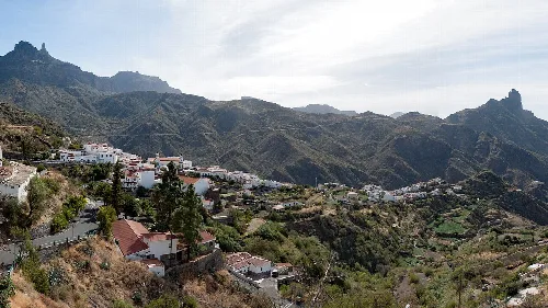
Village of Tejeda with mountains and rocks in the background from the northeast.
Tejeda
Las Palmas · 1,806 inhabitants

Own text, written with AI assistance from the facts in Wikipedia · Santa Lucía de Tirajana · Data: Wikidata Q738674 · Photos: Wikimedia Commons, see individual licenses. · CC BY-SA 4.0